
Weather Alerts for Saline Co.Issued by the National Weather Service |
| No severe weather expected for Saline Co. |
Navigation
Alerts
Mobile Weather
Get SE LincolnWx SmartPhone Weather
 Scan With Phone's Bar Code Reader
US Weather Extremes
| ========== |
| USA |
| High Temp |
| 99°F at Brownsville S Padre Island Intl Ap, TX 99°F at Mcallen Miller Intl Ap, TX |
| Low Temp |
| -12°F at Yellowstone Lake, WY |
| Precipitation |
| 2.97in at Stampede Pass, WA |
| ========== |
NE Weather Extremes
| ========== |
| NE |
| for
Wednesday, March 11, 2026 |
| High Temp |
| 51°F at Lexington Jim Kelly Field, NE 51°F at Mccook Municipal Ap, NE |
| Low Temp |
| 10°F at Alliance Municipal Airport Asos, NE |
| Precipitation |
| 0.35in at Norfolk Karl Stefan Memorial Ap, NE |
| ========== |
| Data from NWS CPC |
External Links
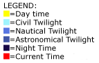
Local Sunlight Hours
| (Noon) |

|
| (Midnight) |
Style Options
Weather Alerts for Saline Co.Issued by the National Weather Service |
| No severe weather expected for Saline Co. |

 
|